THE WORLD WAR II SHIPWRECKS:
Breathing New Life Into Sunken History
How do you thank a place that has changed you in ways you never expected?
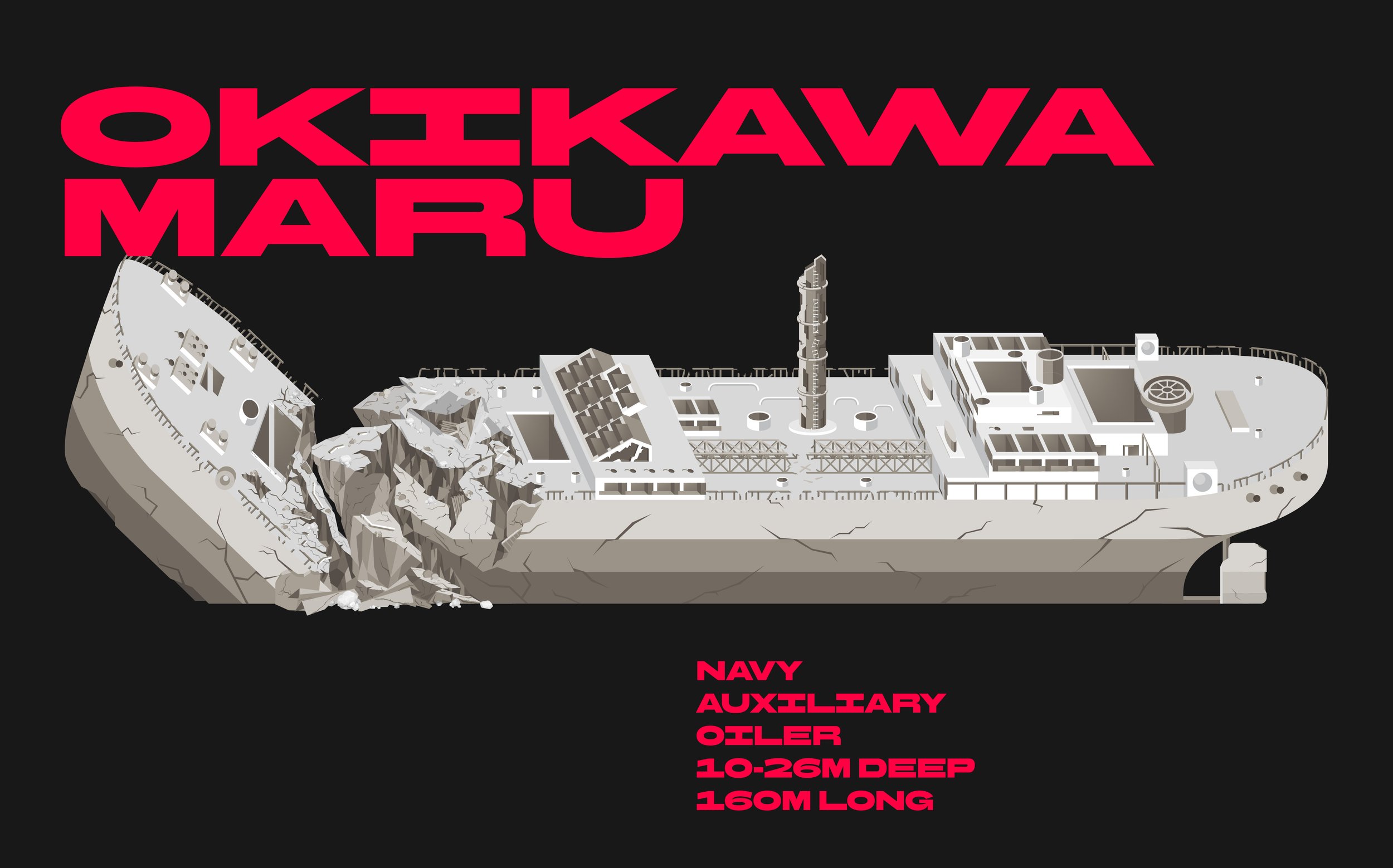
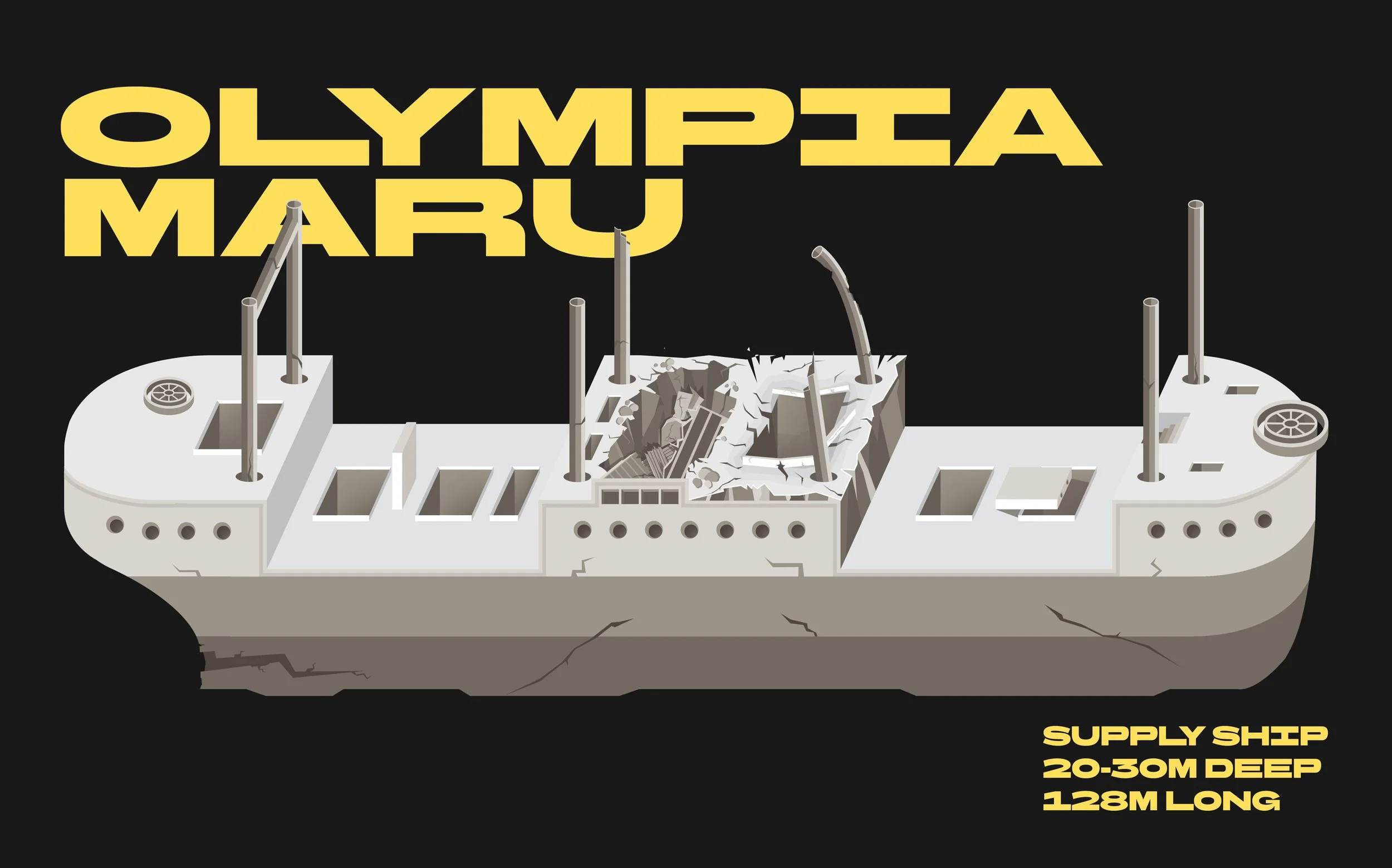
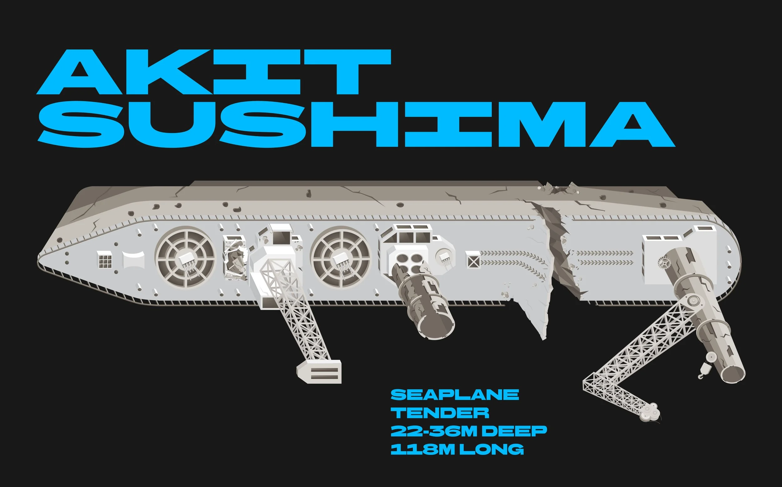
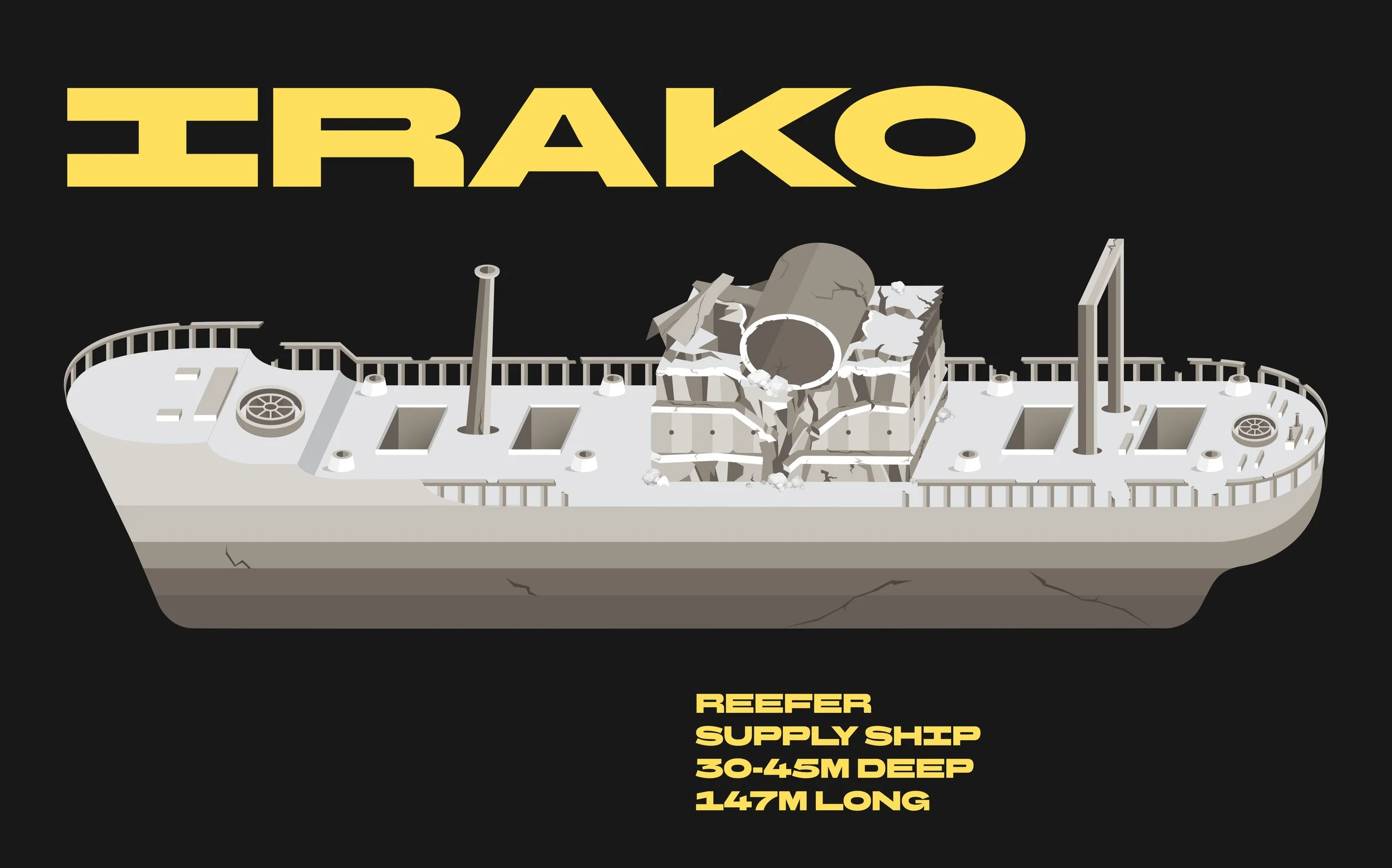
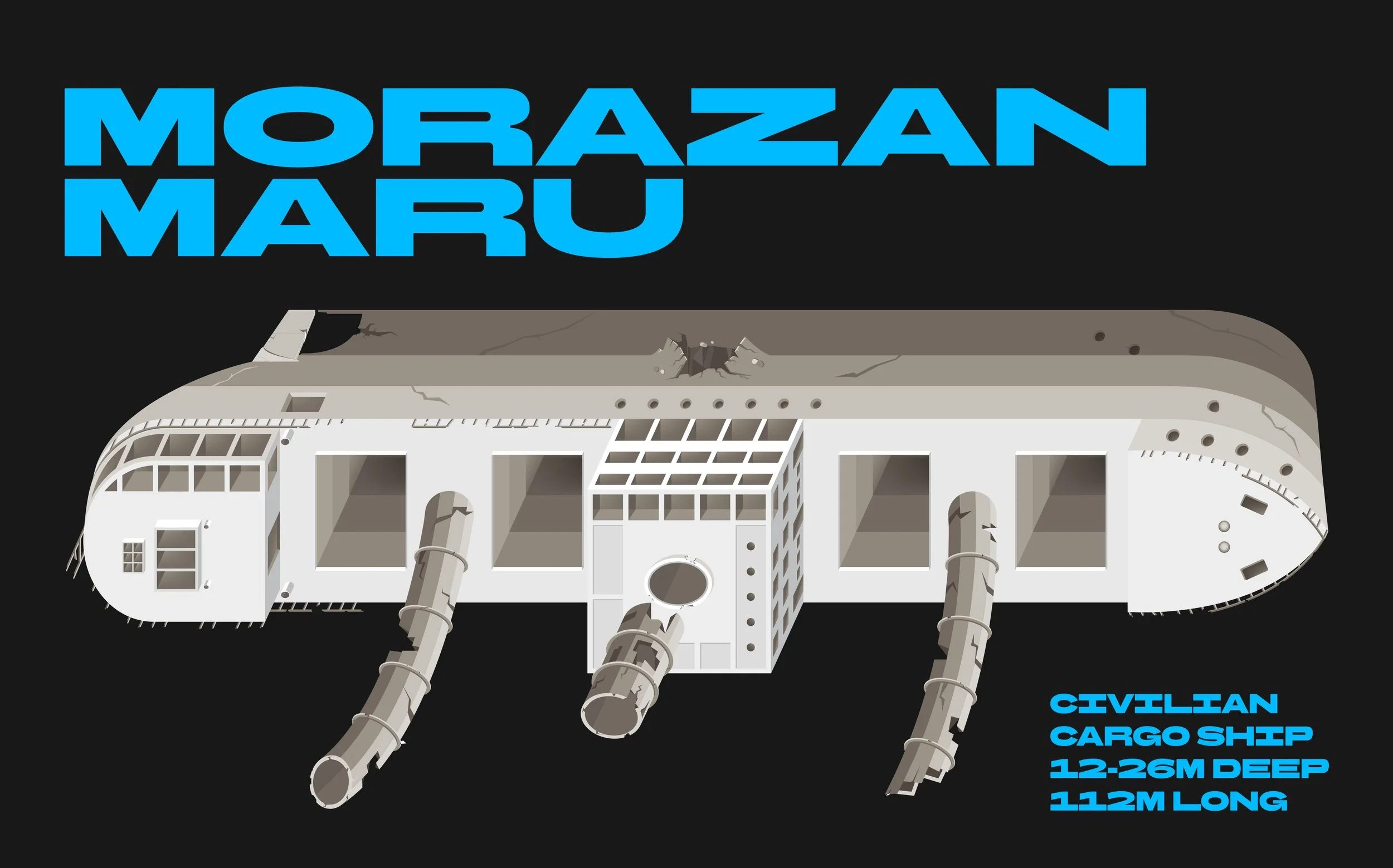
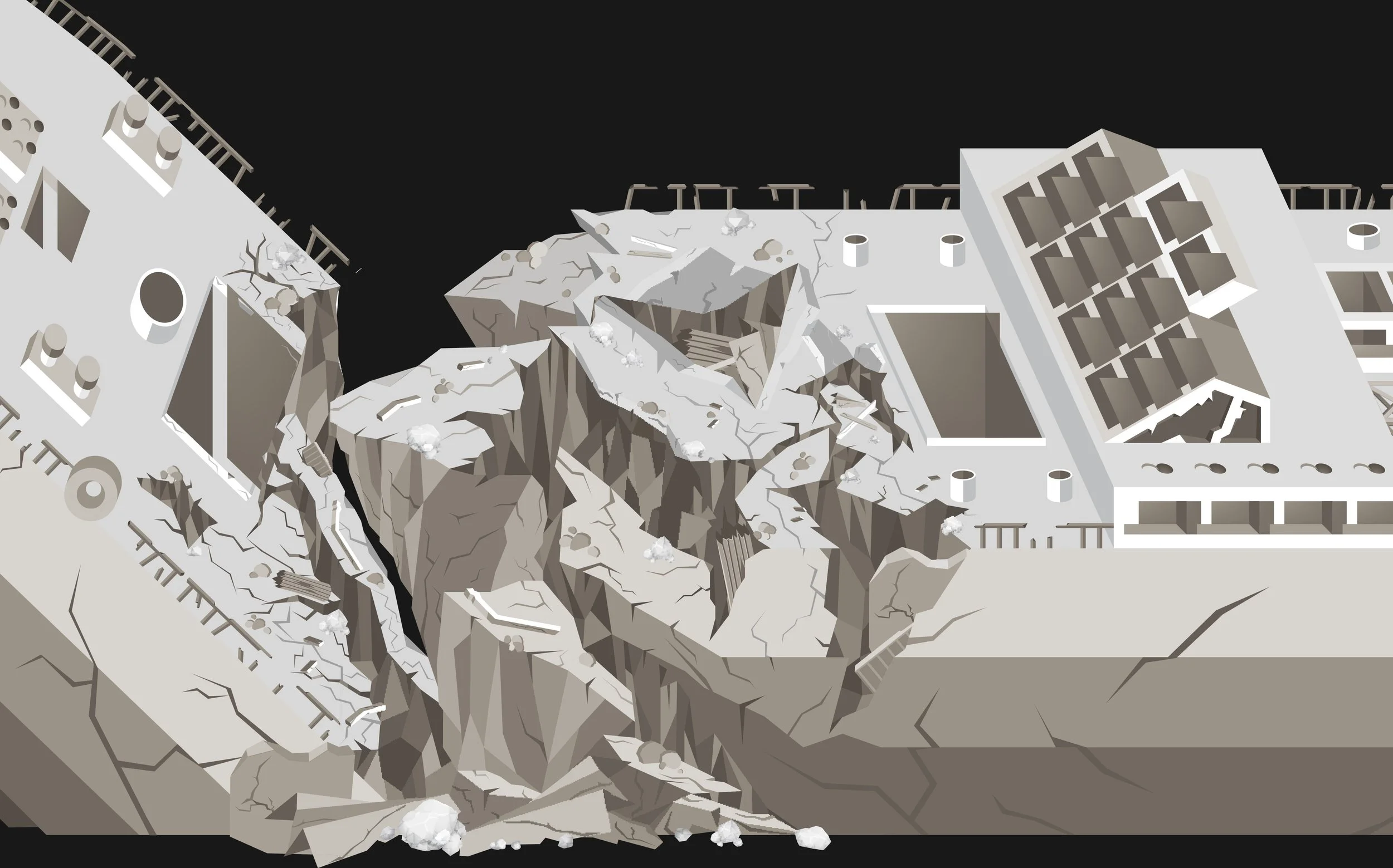
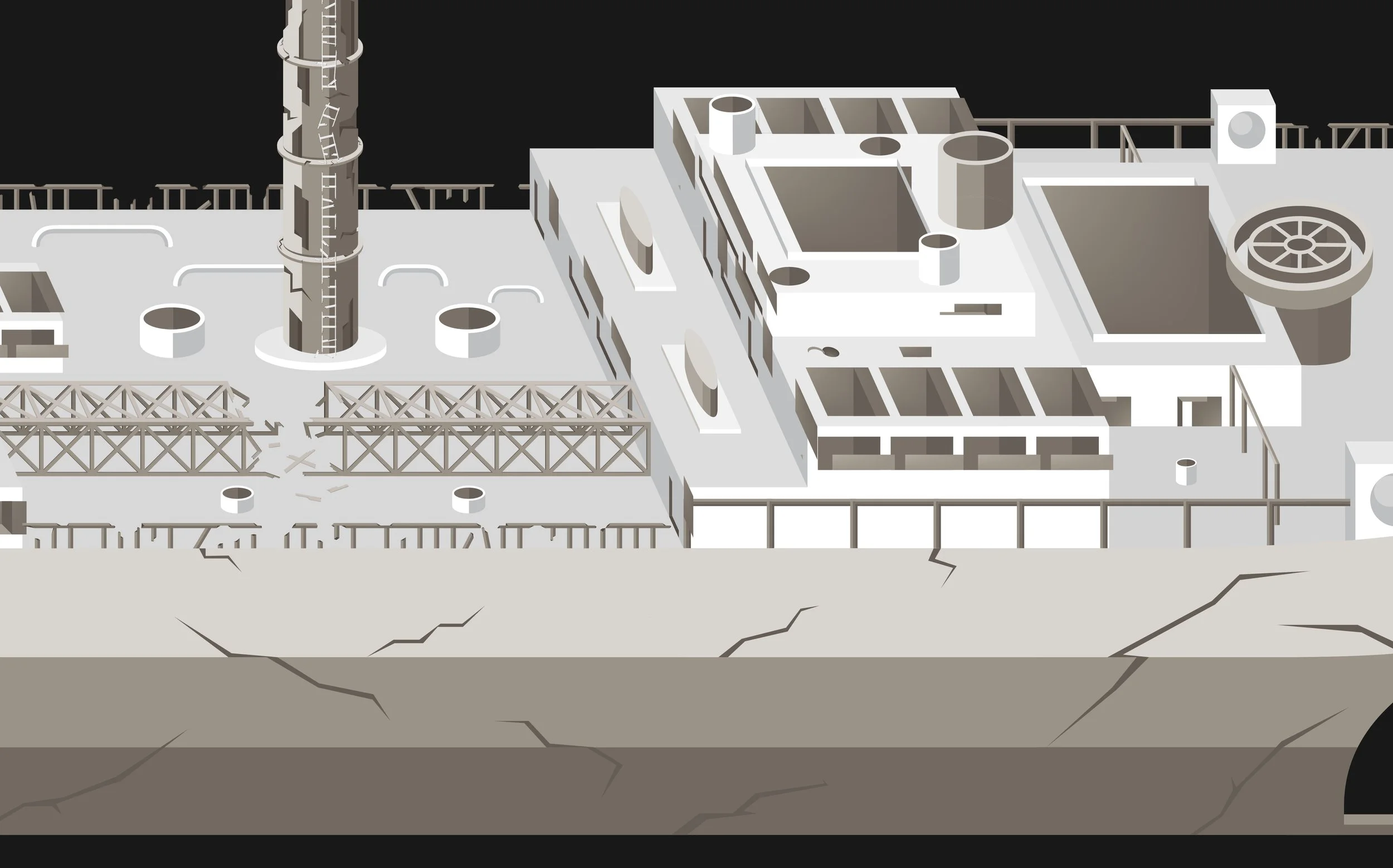
Just off the shores of Coron, Philippines are the bones of several WWII shipwrecks sunk in 1944. Today, they’ve become some of the country’s most iconic dive sites, with massive steel structures turned into thriving coral reefs and living time-capsules from the war.
But here’s the problem:
For years, divers have relied on old, hand-drawn maps to explore these wrecks. They’re charming and impressive, but many are too blurry or no longer accurate. Over time, parts of the wrecks have shifted and collapsed. Some entry points have changed, and some sections no longer exist—making the drawings even harder to trust.
When I was living on a remote island in Coron, I couldn’t swim at first. But with the wrecks just minutes from where I stayed, I slowly fell in love with life underwater. Over two years, these ships gave me some of the most memorable dives of my life. I learned their layout by experience, got to know the resident marine life, and saw firsthand how much the wrecks had changed.
So, I decided to take it on as a personal project.
I wanted to preserve the legacy of these sites while also giving divers a safer, clearer way to navigate them.
In order to do that, I redrew all eight shipwrecks as clean 2D vector illustrations, modernized and based on their current state.


I worked with local dive masters and instructors who know these wrecks by heart, cross-checked every detail, and even went on a few dives to map parts of the wrecks myself when things didn’t line up.
The project took almost a month. But with blended research, local insight, and a few fun dives—it slowly came together.
Today, the maps are being used by dive resorts in Palawan, helping both local and visiting divers explore the wrecks safely.
They provide a more accurate set of illustrations that not only help divers explore safely, but in a way, honors the country that has safeguarded these wrecks for decades. The design and illustrations stay true to how the wrecks appear underwater, while incorporating the colors of the Philippines and presenting important information in a more digestible way.
But this project is more than just maps for me.
It is my personal thank-you to Coron for teaching me how to breathe underwater—for turning fear into skill, giving me my first hundred dives, and showing me a home beneath the surface I never expected.


Old examples of the hand-drawn references that existed before I began the project. I used them as a reference as well—closely studying and dissecting every part, then comparing them with my own underwater experience and insights shared by local divers.